Procore Technologies has announced a series of product advancements to help customers improve collaboration throughout the construction lifecycle.
The company is further innovating its core products – Project Management, Quality, Safety and Construction Financials – while helping users unlock the power of artificial intelligence (AI) and data to drive their businesses forward.
Procore Copilot AI will further integrate into the Procore platform via Microsoft Teams.
This upcoming integration will bring project data and context directly from Procore into Microsoft 365. Procore Copilot AI users will then be able to simply ask questions about Procore projects in Teams, in normal, conversational language, and receive a complete summary of the pertinent information along with links to related information sources.
Users will be able to search for, view and attach Procore project information (such as requests for information (RFIs), Specifications and Submittals) in work on calls, meetings and chats.
AI Locations will allow users to scan project drawings and automatically build out project location lists.
This will unlock the ability to organize project items by location as they’re created in the field later on. Procore will also utilize AI to surface information on RFIs and submittal response time, alongside context on project requirements and industry benchmarks.
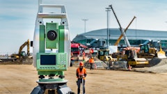
 Procore
Procore Maps will enable viewability of photos on a map to understand work status across all areas of a project to help optimize workflows and reduce delays.
Procore Maps will be able to filter photos on a map by date to pinpoint specific milestones or events captured during a project timeline. Ultimately, this will streamline visual data and support smart decisions on the go. Users will also be able to navigate to where photos are captured directly from the map interface, providing context and clarity to team members regardless of their location.