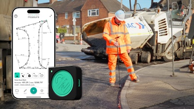
Moasure 2 PRO was developed to eliminate the pain of measuring complex outdoor spaces for asphalt, concrete, and site prep work. It’s now used by over 100,000 professionals.
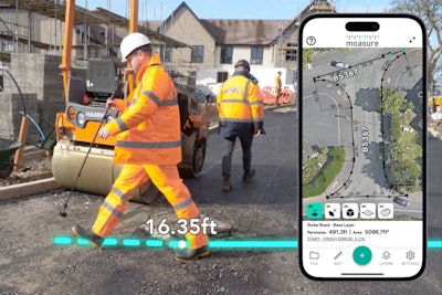
Moasure data can be exported directly to CAD or as a PDF, or CSV file, making it ideal for job quotes and documentation. It’s a faster, simpler way to measure and communicate on and off site.
As the user walks the site, Moasure automatically captures:
- Perimeter
- Area
- Volume
- Surface area
- Elevation changes
As the app captures measurements, it simultaneously draws 2D and 3D diagrams on the user's smartphone or tablet.
Exclusively with Moasure 2 PRO, users can also access Layout Mode – designed to help locate and mark points based on a set of predefined coordinates, without the need for GPS, Wi-Fi, line of sight, or an extra pair of hands. It only requires a Bluetooth connection between the device and app.
By moving the Moasure device from one point to another, users can measure complex and irregular shapes – even across challenging terrain where elevation changes are typical. The intuitive app interface allows users to refine measurements, add annotations and inspect data at their leisure, with an organized filing system they can refer back to at any time.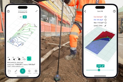
In the Moasure app, construction professionals can export their drawings to CAD, as a PDF, or CSV file. With the newest app update, version 3.0, Moasure has introduced features designed to make measuring, viewing, editing, and exporting even more efficient.
Key new features include:
- Labeling and ignoring data points while measuring
- Color-coded layers for easier identification
- An intuitive Area Calculator to automatically determine net areas between multiple layers within diagrams
- A refreshed app interface with a clean, professional color scheme
- New scaled grid and scale marker options in 2D modes
- 3D Contour View
- Choice of two ways to calculate volume measurements – based on either the measurement’s lowest point or its perimeter
- Upgraded way to visualize the surface of layered measurements
- Improvements to the data available when exporting to CAD
- With 3.0, captured points are now inspectable DXF Point objects
Additional minor updates include:
- New transitions between 2D and 3D views
- Export Point-to-Point measurements as scaled PDFs
- Add a background image to 2D Contour View
- Switch between 2D and 3D views while measuring


